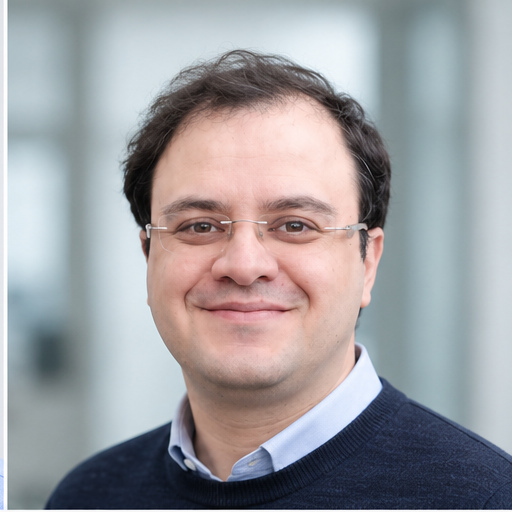
Welcome!
I am a Ph.D. candidate at the University of Potsdam specializing in radar remote sensing, InSAR time-series analysis, and geospatial data science. My research focuses on understanding and monitoring slow-moving landslides, land subsidence, and tectonic deformation using advanced geodetic techniques.
I develop scalable Python workflows and high-performance computing pipelines to extract meaningful insights from satellite observations, transforming complex radar and optical datasets into actionable information for natural hazard assessment and environmental monitoring.
What I Do
🛰️ InSAR & Remote Sensing: Processing multi-temporal SAR data to monitor ground deformation at millimeter precision
📊 Geospatial Data Science: Building automated Python pipelines for large-scale satellite data analysis
🗺️ Geodetic Analysis: Integrating InSAR, GNSS, and LiDAR for comprehensive deformation studies
🔬 Applied Research: Landslide monitoring, subsidence mapping, earthquake analysis, and atmospheric correction
Research Highlights
My work sits at the intersection of geodesy, geophysics, and data science:
Advanced InSAR Processing: Implementing phase-linking and covariance-based methods for signal enhancement in challenging mountainous terrain
Atmospheric Corrections: Developing tropospheric delay mitigation techniques using global weather models to improve InSAR accuracy
Machine Learning Applications: Applying spatial clustering and pattern recognition for automated deformation classification
HPC Workflows: Processing multi-terabyte SAR datasets using SLURM-based parallel computing on supercomputers
Current Research
Ph.D. Dissertation: Landslide Dynamics in the Central Andes
University of Potsdam, supervised by Prof. Dr. Bodo Bookhagen
Investigating slow-moving bedrock landslides in northwestern Argentina through multi-temporal InSAR analysis (2014-2026), with emphasis on: - Seasonal deformation patterns and hydrological controls - Tropospheric correction method evaluation - Multi-sensor geodetic integration - Scalable processing workflows for continental-scale monitoring
Recent Projects
- Groundwater Depletion Monitoring: InSAR-based subsidence analysis in coastal Iran
- Earthquake Sequence Analysis: Geodetic investigation of the 2022 Zagros earthquakes (published in Seismica)
- Data Quality Pipelines: Automated validation tools at Statista Strategy
Learn more about my research →
Technical Expertise
InSAR Tools: ISCE, MintPy, MiaplPy, Dolphin, StaMPS, SARscape, SNAP, GMTSAR
Programming: Python (NumPy, pandas, GeoPandas, scikit-learn, xarray, Dask), MATLAB, R, Bash
GIS & Mapping: ArcGIS Pro, QGIS, ENVI, PostgreSQL/PostGIS
Geodetic Analysis: GAMIT/GLOBK, GNSS-IR, Pyrocko, ObsPy
Computing: High-Performance Computing (HPC), Linux, Git/GitHub, pytest
Recent Publications
2026 - Evaluation of Tropospheric Delay Correction Methods for InSAR Time-Series Analysis. FRINGE 2026, Kraków
2025 - Groundwater depletion and land subsidence in the Minab Coastal Plain. ICCC Workshop, IAG
2024 - Impact of Tropospheric Delay Correction on Landslide Mapping. EGU General Assembly, DOI: 10.5194/egusphere-egu24-12522
2023 - The July-December 2022 earthquake sequence in Zagros mountains. Seismica, DOI: 10.26443/seismica.v2i2.953
Latest from the Blog
Explore tutorials, research updates, and insights on radar remote sensing, InSAR processing, and academic life.
- Introducing NavaSAR: The first public alpha of my physics-based Python library for SAR and InSAR modeling
- InSAR Time-Series Analysis: Processing workflows and best practices
- Atmospheric Corrections: Tropospheric delay mitigation techniques
- Python for Remote Sensing: Code examples and tutorials
- Academic Tips: Research strategies and career development
Professional Experience
Current Positions - Ph.D. Candidate, University of Potsdam (2020-2026) - Data Science Analytics, Statista Strategy, Berlin (2025)
Previous Roles - Student Research Assistant, University of Potsdam (2020-2024) - Scientific Researcher, EFTAS Remote Sensing Technology, Germany (2020) - Visiting Researcher, University of Potsdam (2018-2019) - Research Assistant, Istanbul Technical University (2015-2018)
News & Updates
July 2026 - Completed Ph.D. research on landslide dynamics in the Andes
June 2026 - Presented at FRINGE 2026 in Kraków, Poland on tropospheric correction methods
April 2025 - Started Data Science Analytics position at Statista Strategy in Berlin
March 2025 - Published research on groundwater depletion and subsidence at ICCC Workshop
Get in Touch
I’m always interested in collaborations on: - InSAR applications for natural hazard monitoring - Geospatial data science projects - Machine learning for Earth observation - Open-source tool development
📧 Email: mohseniaref@uni-potsdam.de
📍 Location: Berlin, Germany (Open to relocation)
💼 Seeking: Opportunities in remote sensing, geospatial data science, and Earth observation