About Me
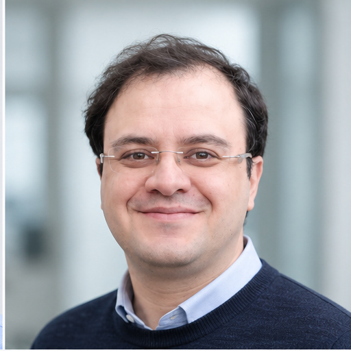
Professional Background
I am a Ph.D. candidate at the University of Potsdam, specializing in remote sensing engineering, InSAR time-series analysis, and geospatial data science. My work sits at the intersection of geodesy, geophysics, and data science, where I develop scalable workflows to extract meaningful insights from satellite observations of Earth’s surface.
With expertise spanning radar remote sensing, photogrammetry, GIS analysis, and high-performance computing, I transform complex multi-temporal satellite datasets into actionable information for understanding natural hazards, environmental change, and tectonic processes.
What I Do
Remote Sensing & InSAR Analysis
I specialize in processing and analyzing Synthetic Aperture Radar (SAR) data to monitor ground deformation at millimeter-scale precision. My work involves:
- Developing automated Python workflows for InSAR time-series processing
- Implementing advanced atmospheric correction techniques (tropospheric and ionospheric)
- Applying phase-linking and covariance-based methods for signal enhancement
- Processing multi-terabyte datasets using HPC clusters
Geospatial Data Science
I bridge the gap between raw satellite data and interpretable geospatial insights:
- Building reproducible analysis pipelines with Python (NumPy, pandas, GeoPandas, xarray)
- Applying spatial statistics and machine learning for deformation pattern recognition
- Creating GIS-ready products for environmental and engineering applications
- Developing CLI tools for data quality control and validation
Applied Earth Observation
My research has practical applications in:
- Landslide monitoring: Characterizing slow-moving bedrock landslides in mountainous terrain
- Land subsidence: Quantifying groundwater depletion impacts on coastal plains
- Seismic deformation: Analyzing earthquake and fault system dynamics
- Infrastructure monitoring: Supporting engineering assessments through automated deformation detection
Current Position
Ph.D. Candidate in Remote Sensing
University of Potsdam, Germany (Expected 2026)
Supervised by Prof. Dr. Bodo Bookhagen
My dissertation focuses on understanding landslide dynamics in the south-central Andes through advanced InSAR time-series analysis, with emphasis on atmospheric correction methods and multi-sensor geodetic integration.
Data Science Analytics (Student Position)
Statista Strategy, Berlin (Apr 2025 - Aug 2025)
Developing Python pipelines for automated data quality control, validation workflows, and reproducible analytics.
Background & Experience
Academic Journey
- Ph.D. Candidate in Remote Sensing - University of Potsdam, Germany
- M.Sc. in Water Resources Engineering - Azad University, Shiraz, Iran (2011)
- B.Sc. in Water Engineering - Bahonar University, Kerman, Iran (2007)
Professional Experience
- Student Research Assistant - University of Potsdam (2020-2024)
- Scientific Researcher - EFTAS Remote Sensing Technology, Münster, Germany (2020)
- Visiting Researcher - University of Potsdam (2018-2019)
- Geospatial Research Assistant - Istanbul Technical University (2015-2018)
Research Philosophy
I believe in:
- Open Science: Developing reproducible workflows and sharing methodologies
- Interdisciplinary Collaboration: Combining geodesy, geophysics, data science, and environmental science
- Practical Impact: Translating research into tools that support hazard assessment and environmental monitoring
- Continuous Learning: Staying current with emerging technologies in remote sensing, ML, and HPC
Technical Skills
InSAR & SAR Processing: ISCE, MintPy, MiaplPy, Dolphin, StaMPS, SARscape, SNAP, GMTSAR, TRAIN
Programming: Python (expert), MATLAB, R, IDL, C/C++, Bash
Python Ecosystem: NumPy, pandas, GeoPandas, scikit-learn, xarray, rioxarray, Dask, PyTorch
GIS & Mapping: ArcGIS Pro, QGIS, ENVI, GMT, PostgreSQL/PostGIS
Geodetic Tools: GAMIT/GLOBK, GNSSRef, GNSS-IR
Geophysics: Pyrocko, Kite, Grond, ObsPy
Software Engineering: Git/GitHub, Linux, pytest, CLI development, API integration
Languages
- Persian: Native
- English: Professional proficiency (C1)
- Arabic: Intermediate (B1)
- German: Elementary (A2)
Professional Development
I continuously expand my expertise through specialized training:
- GNSS Data Processing and Analysis - EarthScope (2024)
- Computer Vision for Earth Observation - IEEE GRSS IADF (2022)
- GNSS Interferometric Reflectometry - UNAVCO (2021)
- Machine Learning with AMD GPUs/ROCm - HLRS Stuttgart (2021)
- Techniques to Study Surface Deformation - RWTH Aachen (2020)
- HPC for Computational Seismology - HLRS Stuttgart (2020)
- Advanced Workshop on Earthquake Fault Mechanics - ICTP Trieste (2019)
- Earth Surface Dynamics Summer School - University of Potsdam (2018)
Beyond Research
When I’m not processing satellite data or writing Python code, I enjoy:
- Exploring new developments in machine learning and computer vision
- Contributing to open-source geospatial tools
- Mentoring students in remote sensing and data science
- Hiking and outdoor photography (especially in mountainous regions)
Location & Availability
📍 Based in: Berlin, Germany
🌍 Open to: Relocation and international collaborations
💼 Seeking: Opportunities in remote sensing, geospatial data science, and Earth observation
“The best way to understand Earth’s dynamic processes is to observe them from space, process them with code, and interpret them with scientific rigor.”